

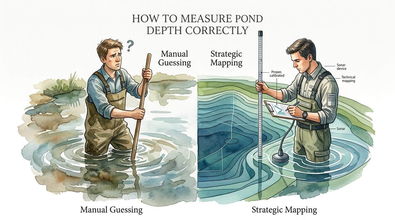
To measure pond depth correctly, establish a systematic grid or transect layout across the water surface rather than relying on a single central measurement. Collect depth data at uniform intervals—typically every 10 to 20 feet—using a weighted sounding line or a calibrated sonar unit. Calculating the arithmetic mean of these points provides the average depth, which is essential for accurate volume estimation, aeration system calibration, and chemical dosage requirements.
Your pond’s ‘deep spot’ might not be where you think it is. Here is how to map it properly. Randomly poking a stick into the water won’t help you plan aeration. Use a strategic grid method to find the true contours and deep pockets of your pond.
Precision in determining underwater topography is a prerequisite for any significant hydraulic or biological management intervention. Subjective estimations of depth frequently lead to a 20–30% error margin in volume calculations, which directly impacts the efficacy of dissolved oxygen (DO) management and the concentration of aquatic treatments.
Professional pond management requires moving beyond anecdotal observations toward bathymetric accuracy. By implementing a standardized measurement protocol, operators can identify thermocline placement, sediment accumulation rates, and the specific locations where anaerobic conditions are most likely to persist.

How to Measure Pond Depth Correctly
Correct depth measurement is the process of quantifying the vertical distance between the static water level and the pond’s benthic substrate across a statistically significant number of coordinates. This data is used to construct a bathymetric profile, which is a three-dimensional representation of the pond’s floor.
In real-world applications, depth data serves three primary functions. First, it determines the required pressure (PSI) for diffused aeration systems, as every 2.31 feet of water depth adds approximately 1 PSI of backpressure to the compressor. Second, it allows for the calculation of acre-feet, the standard unit for chemical applications. Third, it monitors the “lifespan” of a pond by tracking sediment and sludge accumulation over time.
Visualize the pond bottom not as a uniform bowl, but as a series of shelves, slopes, and deep basins. Strategic mapping captures these irregularities, ensuring that equipment like aeration diffusers are placed in the actual deepest points to maximize the “lift” of the water column and prevent dead zones.
Methodologies for Depth Data Collection
Technical execution of depth measurement varies based on pond size and the required resolution of the final map. Three primary methods are standard in the industry.
The Weighted Sounding Line (Manual)
The manual sounding line is the most accessible high-accuracy method for small to medium ponds. It involves a non-stretch cord (such as nylon or coated wire) attached to a heavy, flat-bottomed weight. The weight must be heavy enough to penetrate through thin layers of suspended solids but flat enough to sit on the consolidated bottom without sinking into the clay or liner.
The operator lowers the line until tension slackens, indicating the weight has reached the substrate. The distance from the weight to the water surface mark is measured. Using a non-stretch line is critical; standard rope can expand when wet, introducing a 5–10% error in deep water measurements.

Portable Sonar and Fish Finders (Electronic)
Electronic depth finders use acoustic transducers to send a “ping” to the bottom and measure the return time. Modern portable units, often castable or boat-mounted, provide real-time digital depth readings. This method is significantly faster than manual sounding and allows for the collection of hundreds of data points in a single session.
However, sonar can be deceived by “soft” bottoms. In ponds with high organic muck or dense submerged vegetation, the acoustic signal may bounce off the top of the weed bed or the loose sludge layer rather than the firm bottom. Operators must calibrate these units and occasionally verify readings with a manual probe.
Integrated GPS Bathymetric Mapping
For large impoundments or professional-grade surveys, sonar units are integrated with Global Positioning System (GPS) receivers. As a boat traverses the pond, the system logs the depth and the exact geographic coordinates simultaneously. This raw data is then processed through software to generate a contour map with 1-foot or 2-foot intervals. This provides the most accurate volume calculation possible.
Establishing a Strategic Grid and Calculating Volume
Mapping the pond’s contours requires a structured approach to ensure the data represents the entire body of water.
The Grid Method
Divide the pond into a series of imaginary squares. For a 1-acre pond, a grid of 25′ x 25′ is usually sufficient. Navigate to the center of each square (or the intersection of grid lines) and record the depth. This uniform distribution prevents the “over-sampling” of shallow edges or deep centers, which would skew the average depth calculation.
The Transect Method
If a full grid is not feasible, the transect method uses cross-sectional lines. Run a minimum of two perpendicular transects—one along the longest axis (Length) and one across the widest point (Width). Take measurements at 10-foot intervals along these lines. For irregularly shaped ponds, additional transects should be added through any coves or finger-like extensions.
Calculating Average Depth and Volume
Once the data points are collected, calculate the average depth using the following formula:
Average Depth = Sum of All Depth Measurements / Number of Points Measured
To calculate the total water volume in gallons for a rectangular pond:
Volume (Gallons) = Length (ft) x Width (ft) x Average Depth (ft) x 7.48
For professional management, the result is often converted to acre-feet:
Acre-Feet = Surface Acres x Average Depth (ft)
(Note: 1 surface acre = 43,560 square feet).
Benefits of Strategic Mapping vs. Manual Guessing
Adopting a data-driven approach to pond measurement offers measurable operational advantages.
| Factor | Manual Guessing | Strategic Mapping |
|---|---|---|
| Aeration Efficiency | Sub-optimal placement; high risk of “dead zones.” | Diffusers placed in true deep basins; maximum water lift. |
| Chemical Dosing | Risk of under-dosing (ineffective) or over-dosing (toxic). | Precision calculations based on actual acre-feet. |
| Cost Control | Higher long-term costs due to equipment failure. | Optimized power consumption and chemical use. |
| Sediment Tracking | Impossible to track without a baseline. | Clear data on sludge accumulation rates over years. |
Challenges and Common Pitfalls
The most frequent error in pond depth measurement is failing to account for the “sludge layer.” In many established ponds, the bottom consists of 6–12 inches of loose, organic muck. A sounding weight might stop on top of this muck, while a heavy pole might sink through it to the original clay base. Management decisions must distinguish between “water depth” (above the muck) and “total basin depth” (to the firm bottom).
Another common mistake is neglecting the water level fluctuations. Depth measurements are only a “snapshot” in time. If the pond is measured during a spring high-water event, the volume will be significantly overestimated compared to late summer levels. Always record the “freeboard” (the distance from the water surface to a fixed point, like a dock or spillway) at the time of measurement to allow for future adjustments.
Limitations of Measurement Techniques
While modern sonar is highly effective, it has limitations in extremely shallow water (under 2 feet) or areas with near-100% vegetation coverage. In these zones, the “surface noise” of the transducer can lead to erratic readings. Manual sounding is the only reliable method in dense lily pads or weed beds.
Furthermore, extremely small ponds (under 1/8th acre) may not benefit from complex bathymetric mapping. In these cases, the effort of establishing a grid may outweigh the marginal increase in accuracy. Simple center-point and edge-point measurements are often sufficient for basic fountain installations or small ornamental filters.
Practical Tips for Accurate Field Work
- Use a “Sludge Judge”: This clear plastic tube allows you to see the exact thickness of the sediment layer compared to the water column.
- Tension the Line: When using a manual sounding line, ensure the weight is heavy enough to keep the line vertical against wind or currents.
- Calibrate your GPS: If mapping with a smartphone or handheld GPS, verify accuracy against a known landmark. Consumer-grade GPS can have a 10–15 foot error margin.
- Perform Measurements in Calm Weather: Wind-driven waves make it difficult to keep a boat stationary and can cause “bounce” in sonar readings.
Advanced Considerations for Sediment Monitoring
Serious practitioners use depth measurement as a diagnostic tool for pond aging. By comparing a bathymetric map from Year 1 to Year 5, you can calculate the exact volume of sediment accumulated. This “Sedimentation Rate” is critical for budgeting future dredging projects. If a pond is losing 0.5 inches of depth per year across its entire footprint, you can predict exactly when the basin will no longer support fish life or effective aeration.
Additionally, understanding the slopes (the “grade”) of the pond bottom helps in identifying erosion hotspots. Steep slopes are more prone to sloughing, which contributes to rapid sediment build-up in the deep zones.
Scenario: Sizing an Aeration System
Consider a pond with a surface area of 0.75 acres. A single measurement in the center shows 12 feet of depth. However, a grid measurement reveals that 60% of the pond is only 4 feet deep, and there is a secondary deep pocket of 14 feet near the dam that was previously unknown.
If the owner sized an aeration system based on a “guessed” average depth of 10 feet, the compressor might be under-powered for the 14-foot pocket, leading to poor oxygenation in the very area it is needed most. By using the grid method, the owner identifies the two distinct basins and places a diffuser in each, ensuring total lake turnover and higher system efficiency.
Final Thoughts
Accurate depth measurement is the foundation of scientific pond management. It transforms a pond from an unknown “black box” into a manageable hydraulic system with predictable requirements. Whether using a simple weighted line or advanced GPS-integrated sonar, the goal is the same: the collection of uniform, repeatable data.
By moving beyond random poking and visual estimation, pond owners can save significant capital on chemical treatments and electrical costs. Understanding the true contours of the pond allows for the strategic placement of habitat and aeration, ultimately leading to a more stable and healthy aquatic ecosystem.

Frequently Asked Questions About How to Measure Pond Depth Correctly
What is the most accurate tool for measuring pond depth?
For professional accuracy, a GPS-integrated sonar unit is the gold standard, as it correlates depth with geographic coordinates to create a 3D bathymetric map. However, for most pond owners, a non-stretch weighted sounding line or a “Sludge Judge” provides the highest accuracy in terms of distinguishing between the water column and the organic sediment layer. Sonar can sometimes be fooled by thick vegetation or “soft” muck, so manual verification at a few points is always recommended to calibrate electronic devices.
How often should I measure the depth of my pond?
Depth should be measured at least every three to five years to monitor sediment accumulation. If you are noticing increased algae growth or “muck” odors, more frequent monitoring may be necessary. Additionally, you must measure the depth before installing any new aeration system, fountain, or before applying major chemical treatments. Changes in depth due to erosion or organic decomposition can significantly alter the volume of the pond, rendering old data obsolete and leading to management errors.
Can I use Google Earth to find my pond’s depth?
Google Earth and other satellite imaging tools can accurately measure the surface area (acreage) and perimeter of a pond, but they cannot determine underwater depth. Satellite sensors cannot see through water to map the benthic contours. To find the depth, you must perform physical “in-situ” measurements using a boat or by taking samples from the shore using a long probe if the pond is small enough. Some government databases may have bathymetric data for large public lakes, but private ponds almost always require manual mapping.
Does a “soft” bottom affect depth measurements?
Yes, a soft bottom consisting of decomposed organic matter (muck) can significantly obscure true depth. Sonar signals may reflect off the top of the “fluff” layer, while a heavy weight might sink through it. This creates a discrepancy between “apparent depth” and “firm depth.” Correct measurement requires identifying both: the distance to the top of the muck (for aeration placement) and the distance to the firm substrate (to understand the pond’s total capacity and dredging needs). Using a Sludge Judge is the most effective way to quantify these two distinct layers.
How many data points do I need for an accurate average depth?
The number of points depends on the complexity of the pond’s shape. For a basic rectangular or circular 1-acre pond, a minimum of 15–20 evenly spaced measurements is required for a reliable average. If the pond is irregularly shaped with coves, islands, or varying slopes, you should increase the density of your measurements to ensure no major basins or shelves are missed. A general rule of thumb is to take a measurement every 20 to 25 feet along your grid or transect lines to capture the true topography.